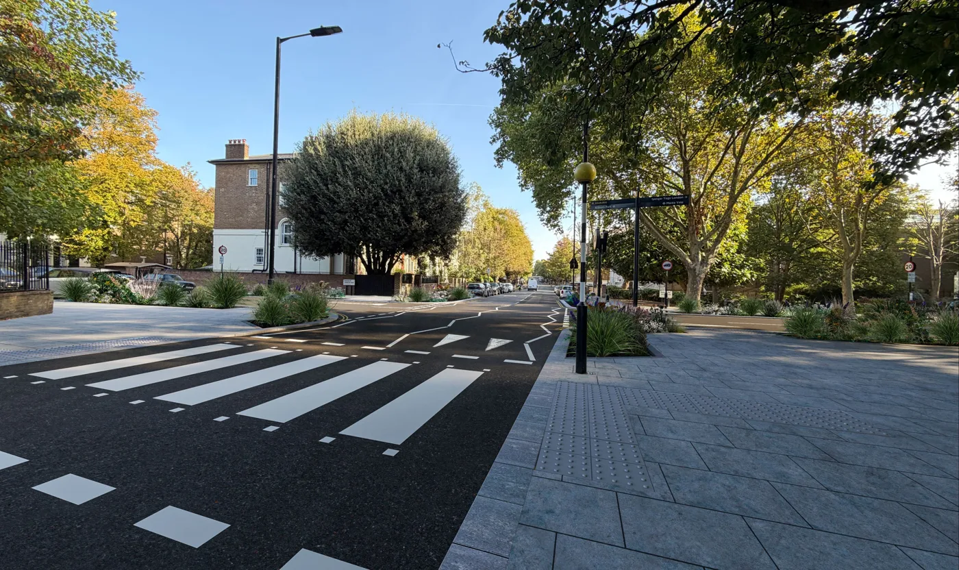

Westminster wants views on rain gardens and permeable paving for Maida Vale and Carlton Vale, with drop-ins on 28 Nov and 1 Dec. The survey closes 14 December.
Westminster City Council wants to dig rain gardens and lay water-storing paving along Maida Vale and Carlton Vale, and residents have until midnight on Monday 14 December to comment on the plans. Building is due to start in summer 2027.
The council says the work is meant to “reduce flood risk and make streets more climate resilient by introducing sustainable drainage in areas where they can provide the greatest benefits”. The proposals, it says, “include permeable paving, rain gardens, soft landscaping and planting beds, helping to create greener, more flood-resilient streets.”
The plans, a survey and the dates of three events where you can meet the project team are on the council’s Westminster SuDS Programme website. SuDS stands for sustainable drainage systems.
Why Maida Vale
The council’s background page goes back to July 2021, when “two major flash flood events affected over 400 properties across Westminster”. It adds that “many residents [were] forced to leave their homes for a year or more” and that climate change “is expected to increase both the frequency and severity of these events.”
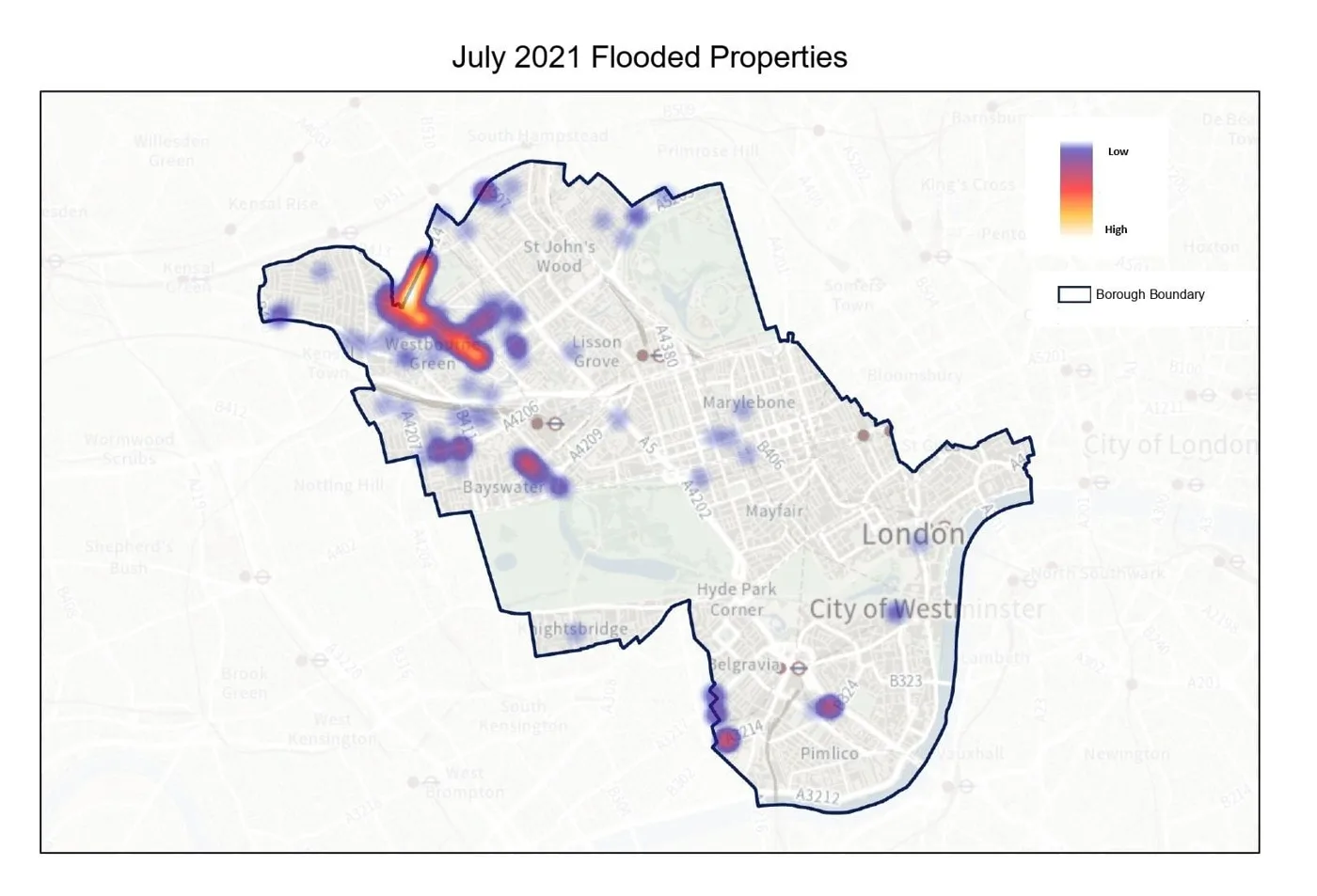
The council’s own map of the properties flooded that July puts the worst of the damage in the north-west of the borough, with smaller clusters in Bayswater and Pimlico.
The council has committed £3.7 million to a borough-wide programme. Its masterplan splits Westminster into 14 drainage catchments, “areas where rainfall naturally flows towards key drainage points”, and ranks them on “historic flooding, drainage capacity, environmental impact and social value”. The target is to cut surface water above ground by 15% during a 1 in 30 year rainstorm by 2030, within those catchments.
What is planned on Carlton Vale
The Carlton Vale plan, dated October 2026, shows strips of permeable paving with underground storage along both sides of the road, rain gardens on all four corners of the Randolph Avenue junction, and a further rain garden and paving strip on Carlton Hill.
The junction itself would be raised. The plan describes this as “traffic calming measures, including a raised junction and footway buildouts, to help slow vehicles, improve visibility and enhance the safety and comfort of people walking through the area.” A cycle hangar on Carlton Vale would be moved.
The council’s Carlton Vale page explains the two main pieces:
- Permeable paving “captures and stores surface water underground, allowing it to filter into a traditional drainage system at a controlled rate to reduce the risk of flooding.”
- Rain gardens are “engineered features designed specifically to capture, store and filter rainwater runoff”, built with “specially designed soils, inlets and outlets”, which “can include trees and planting”.
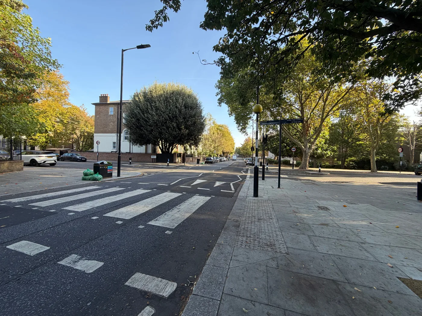
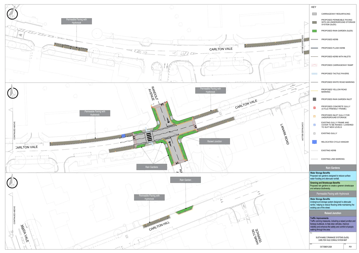
2 photos, swipe or scroll. Photos: Westminster City Council
Parking spaces
Some spaces would go. The Carlton Vale page says “some of the SuDS features would require a small number of parking spaces to be removed at key locations. This is proposed only where parking occupancy is low.”
The council’s FAQs say bays are only replaced “where the SuDS feature is high value in terms of the catchment size and volume of rainwater attenuated”, and that “we would consult on any proposed changes to parking before they go ahead.” Pavements, they say, “will be kept in line with accessibility standards so people with mobility needs, including wheelchairs and pushchair users, can still get around safely.”
What is planned on Maida Vale
The Maida Vale scheme is longer and leans more on planting. The two plans (sheet 1 and sheet 2) show rain gardens set into the kerb line beside the bus lanes, and a long run of shallow planted beds around the existing street trees.
The Maida Vale page lists four kinds of feature. Alongside permeable paving and rain gardens there would be:
- Soft landscaping: “areas of planting introduced around existing trees to replace hard surfaces with greenery”, which “allow more water and air to reach tree roots”.
- Planters with low-level planting: “shallow planted areas that introduce greenery where rain gardens are not practical.” The council says their main purpose is the streetscape and wildlife, though “they can also help slow surface water runoff”.
The plans mark the shallow beds and garden beds as “non-SuDS landscaping”: greenery, rather than drainage.
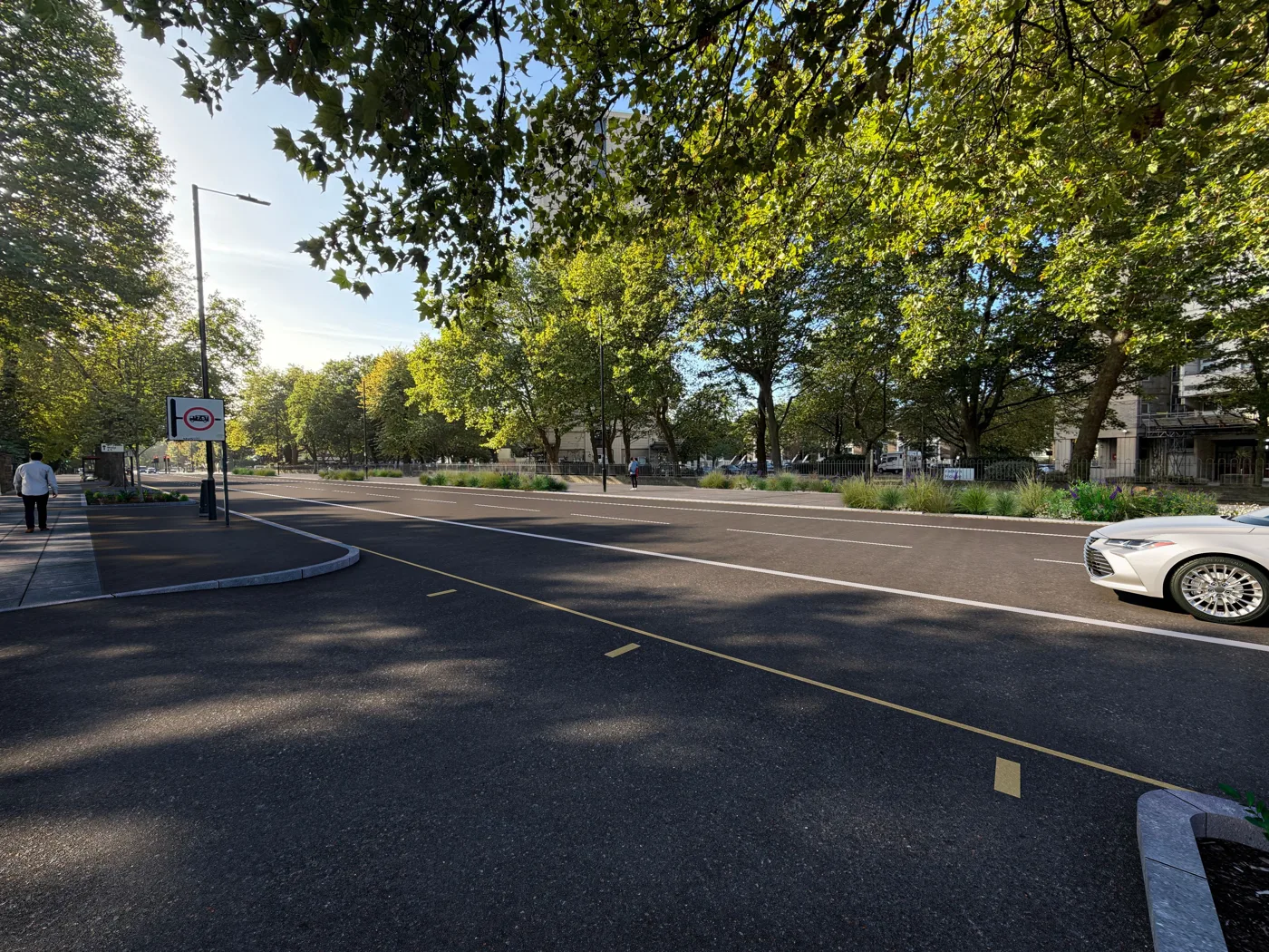
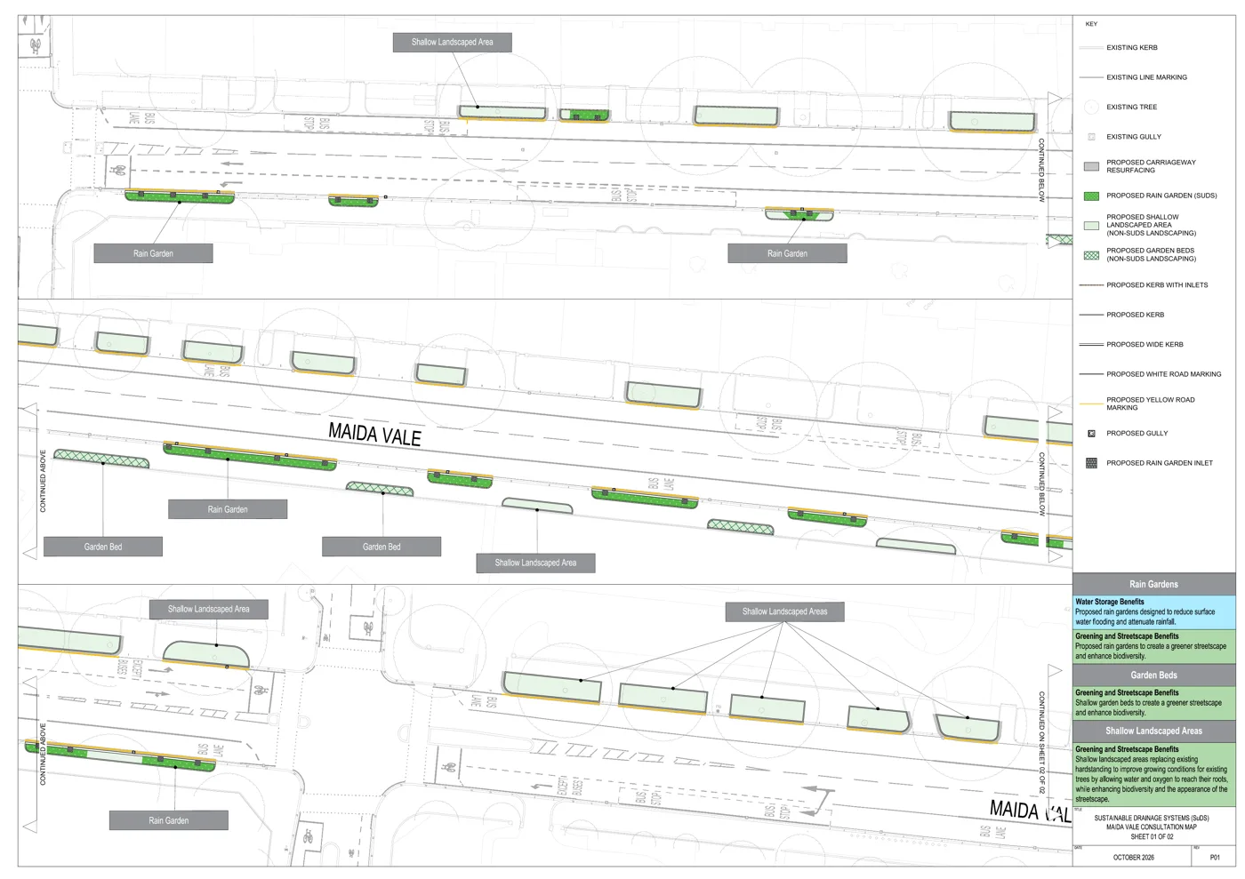
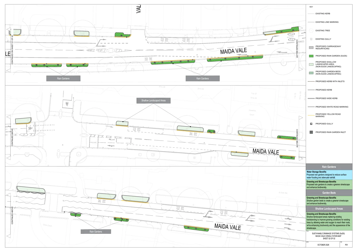
3 photos, swipe or scroll. Photos: Westminster City Council
What it looks like nearby
The council has already built rain gardens at Maida Hill Market, Queen’s Park Canalside, Shepherd Market, Elgin Avenue and Westbourne Green Canalside, according to its background page. It plans to fit probes that “measure the amount of rainwater stored” to see how well they work.
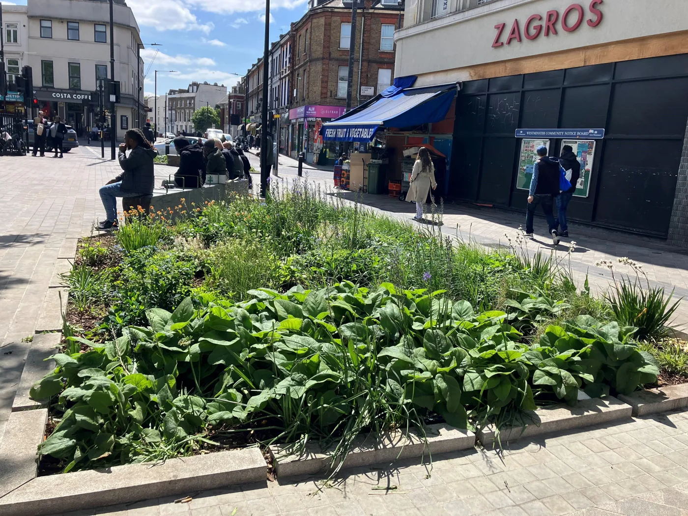
The FAQs are frank about the limits: “A single feature won’t prevent flooding on its own, but the effect is cumulative: the more SuDS are delivered across Westminster, the more rainwater is held back, and the lower the risk of flooding becomes.”
What it means for you
If you live on or near either road, or park there, this is the stage at which the design can still change. The council says it will “review all feedback and incorporate it in the design, where possible, before construction begins”, though it adds that the survey only asks about “the aspects of the designs that the community can genuinely influence”.
How to take part, by midnight on Monday 14 December:
- Online: fill in the survey on the SuDS Programme website.
- On paper: hard copies of the plans and questionnaire are at Maida Vale Library, Sutherland Avenue, W9 2QT.
- Online event: Tuesday 17 November, 6pm to 7pm, on Microsoft Teams. You need to register first.
- In person: Saturday 28 November, 1pm to 5pm, and Tuesday 1 December, 12pm to 3pm, both at the Park Café in Paddington Recreation Ground, W9 1PD.
The council says it does not expect detailed comments by email, but anyone who has difficulty taking part can write to suds@westminster.gov.uk.
When the work happens: construction on both roads is expected to start in summer 2027, and the council says it will tell residents beforehand how the works will be managed. Its FAQs give working hours of 8am to 6pm on weekdays and 8am to 1pm on Saturdays.
You can also suggest other streets: the FAQs say “residents can suggest possible locations for SuDS”, which are then assessed the same way as the masterplan sites. A blocked or damaged rain garden can be reported through the council’s Report It page.
Have your say